Living with Horses Among the Whispering Pines

Today marks the third anniversary of the day I bought my house in the Pine Barrens in a development called “Whispering Pines.” I recently reread John McPhee’s The Pine Barrens and laughed at the irony when I came across this quote. 

“Meanwhile, up goes a sign—“Whispering Pines, Two and Three Bedrooms, $ 11,900” —and down go seventy-five acres of trees.”

McPhee, John. The Pine Barrens (p. 156). Farrar, Straus and Giroux. Kindle Edition.

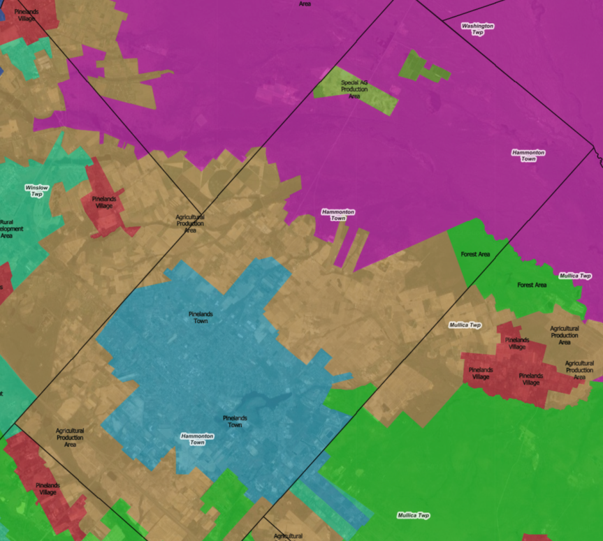
McPhee expressed his concern about encroaching development on the Pine Barrens in 1968. 10 years later Congress passed the first legislation protecting the Pinelands. When I bought the house, I wasn’t looking for one located among the Pines. My number one criteria was close proximity to the farm where I boarded my horse in Shamong. After I settled into my house, I learned that my new township of Waterford was located entirely within the Pinelands boundaries. My house was built in 1997 in the regional growth area of Waterford, the most developed part of the western half of the township. Except for the incongruous presence of Atco Dragway, however, the eastern half of Waterford remains rural, home to horse farms and dominated by Wharton State Forest.

When I moved here, my goal was to devote more time to horseback riding. In spite of setbacks posed by the pandemic and a broken ankle, I achieved an important milestone this year when my horse and I won the championship of our division as well as a year-end high point reserve championship. Next year, we move out of the starter division and into open competition. More importantly, I continue to develop my network of friends in the equestrian community. I am also finding opportunities to do more freelance writing again.

I am contributing an article about horse racing in the Pine Barrens to a book being published for Linda Stanton’s “Lines on the Pines” at Stockton University in 2023. Originally, I intended to write about Atlantic City Racecourse in Mays Landing, the famous defunct race track founded by Jack Kelly, father of Princess Grace. As I researched, though, I discovered much more, such as the colorful history of Rancocas Stud, now known as Helis Stock Farm, located in the Jobstown section of Springfield in Burlington County. Founded by Pierre Lorillard IV, heir to the Lorillard Tobacco Company fortune, it passed to Lily Livingston, a member of the Canadian Racing Hall of Fame and then to Harry Sinclair, an oil baron who became embroiled in the Teapot Dome scandal. The farm produced top racehorses Iroquois, Grey Lag and Zev before another oil baron William Helis purchased and renamed it.

Another Thoroughbred owner, Anthony Imbesi of Briardale Farm, raced champion mare Tosmah. Tosmah was buried at the Estell Manor farm about a half hour from Atlantic City Racecourse where she once raced. 

I also learned about the “Golden Triangle” of New Jersey racing: Atlantic City, Monmouth Park, and Garden State Park. In addition to my “Lines on the Pines” article, next year, I’m writing an expanded article covering horse racing throughout South Jersey for SoJourn, Stockton’s biannual journal covering South Jersey history, culture, and geography. One topic will include more information about Garden State Park. I plan to share some highlights from my research on this blog next year.

Sally Starr 

In honor of my third anniversary living among the whispering pines, here’s a short profile of a famous Waterford resident and horsewoman, local television personality Sally Starr. Sally hosted a popular Philadelphia children’s television program through the 1950s and 1960s called Popeye Theater. The program ended in 1971. 

Sally lived in Waterford in her later life where she sold the rights to a local restaurant to use her name. Located a short distance down the road from Atco Dragway, “Sally Starr’s Pizza” still operates. An employee told me she did not own the restaurant but ate there regularly. She did, however, at one point, own a former dude ranch in Voorhees, which she attempted to turn into a restaurant/dance hall called “The Ponderosa.”

Sally passed away in 2013 at age 90. According to her obituary, she once owned a farm in New Jersey, and three horses (Silver Kane, Rustic Rhythm, and Pal) that “she rode with a silver saddle worth $5,900.” She planned to start a string of shelters for abused children. One was already in the works in Burlington County – Sally Starr’s Bar-None Ranch.” Her social consciousness also encompassed longtime support of LGBT rights.

Her biography on the Broadcast Pioneers website offers more detail about her love of horses: she bought Pal the palomino as a 3-year-old in Trenton for $1,000 and owned him until his death at age 25. Silver Kane, a palomino stallion she purchased for $3500, was sired by one of the horses who played the Lone Ranger’s Silver. 

In 1972, Sally published an autobiography entitled Me, Thee, & TV. In 1995, she was inducted into the Broadcast Pioneers of Philadelphia Hall of Fame.

Photograph of Sally Starr on a Palomino Horse with Western tack Hanging at Sally Starr's Pizza restaurant
Photograph of Sally Starr Hanging at Sally Starr’s Pizza restaurant

A Good Friday Eagle to Mark the Easter Triduum

Happy Easter! It’s my custom to take the day off for Good Friday. This year I spent about an hour hiking at Edwin B. Forsythe Wildlife Refuge. Along Wildlife Drive, I got some great photos of a hunting bald eagle that I’m calling my Good Friday Eagle. It was the first eagle I saw at Forsythe this year and these are the best shots of an adult bald eagle that I have taken to date. I also saw a juvenile, but it was too far and soaring too high for decent photos.

Adult Bald Eagle hunting at Edwin B. Forsythe National Wildlife Refuge on Good Friday 2022
Good Friday Hunting (Photo by Beach and Barrens)

I noticed species of birds that spend the winter in warmer climates returning for nesting season. I spotted snowy egrets, glossy ibis, and laughing gulls for the first time this year. Ospreys started returning a few weeks ago, and I photographed one with freshly captured fish. I also took this shot of a great egret coming into breeding plumage with green appearing around its bill and long plumes in back.

Great Egret showing breeding plumage at Edwin B. Forsythe National Wildlife Refuge on Good Friday 2022
Great Egret on Good Friday (Photo by Beach and Barrens)

Celebrating Easter in Brigantine and the Pine Barrens

Before visiting Forsythe on Friday, I spent some time in Egg Harbor City. I stopped at Nancy’s Country Kitchen for lunch, a roadside breakfast cafe along the White Horse Pike with a small lunch menu. Then I visited Egg Harbor Lake Park to take some photos for an upcoming post.  Before heading home, I stopped in Brigantine for the Good Friday Service at St. Thomas’s, my former parish. Good Friday is part of the Easter Triduum, a period of time starting the evening of Holy Thursday and completing with Easter.

I started off Easter Sunday with early morning Mass at Christ the Redeemer, my current parish in Waterford. Christ the Redeemer, which formed from the merger of several different parishes in 2010, actually holds services at three different worship sites: Assumption Church, Sacred Heart Church, and St. Anthony’s Church, a small country chapel very near the border of Wharton State Forest. The rest of my day was spent visiting family in Sicklerville and Absecon before having dinner with friends in Shamong. I hope everyone else was able to spend Easter with good friends and family!

What are the Pinelands CMP Designations? Here’s a Quick Cheatsheet!

The screenshots in this post were taken from the interactive New Jersey Conservation Blueprint Ecological Integrity Map and used with permission of Rowan University. 


When the Pinelands Comprehensive Management Plan became effective in 1980, it designated nine management areas regulating land use. As an example, this screenshot shows the six designations in my township of Waterford. 

Screenshot of map showing the New Jersey Pinelands Comprehensive Management Plan designations in Waterford
Waterford Pinelands CMP Designations (Used with Permission of Rowan University)

Preservation Area District 

  • The “heart of the Pinelands environment and the most critical ecological region.”
  • Residential development: restricted to “one-acre lots in designated infill areas” and “minimum 3.2 acre lots for property owned by families prior to 1979.
  • Commercial/recreational uses: limited to “designated infill areas.” 

Forest Area 

  • This is “largely undeveloped area that is an essential element of the Pinelands environment.”
  • Residential development: “Clustered housing on one acre lots” with “an average residential density of one home per every 28 acres.”
  • Commercial/recreational uses: “Roadside retail within 300 feet of pre-existing commercial uses” as well as “low intensity recreational uses.”

Rural Development Area

  • This area balances “environmental and development values between conservation and growth areas.”
  • Residential: “Clustered housing on one acre lots” with “an average residential density of one home for every five acres.”
  • Commercial/recreational:  Roadside retail and “community commercial, light industrial and active recreational uses served by septic systems.”

Regional Growth Area 

  • This area consists of “existing growth and adjacent lands capable of accommodating regional growth influences while protecting the essential character and environment of the Pinelands.”
  • Residential development: Densities include “two to six homes per acre with sewers.” 
  • Commercial/recreational use: “Sewered commercial and industrial uses.”

Agricultural Production Area

  • This area consists of “active agricultural use, generally upland field agriculture and row crops, together with adjacent areas with soils suitable for expansion of agricultural operations.” 
  • Residential development: “Farm-related housing on 10 acres and non-farm housing on 40 acres.” 
  • Commercial/recreational use: “agricultural commercial and roadside retail within 300 feet of preexisting commercial uses.”

Pinelands Villages 

  • 47 small settlements, most without sewers, scattered throughout the state-designated pinelands area. 
  • Residential development: “lots between one and five acres.”
  • Commercial/recreational use: Must be “compatible with their existing character.” 

Neighboring Hammonton contains five of the same areas except for a Pinelands Village area. It does, however, include two areas not found in Waterford as this screenshot displays.

Screenshot of map showing the New Jersey Pinelands Comprehensive Management Plan designations in Hammonton
Hammonton Pinelands CMP Designations (Used with Permission of Rowan University)

Special Agricultural Production Area 

  • These include “areas within the Preservation Area primarily used for berry agriculture and horticulture of native Pinelands plants.” 
  • Residential development: Only “farm-related housing on 40 acres and cultural housing exceptions on 3.2 acre lots.”

Pinelands Towns 

  • Seven large settlements “generally with wastewater or water supply systems.” 
  • Residential development: “density of two to four homes per acre with sewers.”
  • Commercial/recreational use: “Sewered commercial and industrial uses.”

The remaining CMP designation is Military and Federal Installation Area, which includes military and federal areas with permitted uses “associated with the function of the installation or other public purpose uses.” An example of this area is the William J. Hughes FAA Technical Center in Egg Harbor Township.

The Best of Both Worlds in Waterford

Hope everyone had a great Thanksgiving! Last week, Waterford Township repaired the sewer lateral that caused some plumbing issues for me so I was able to enjoy the holiday with visits to family in Egg Harbor Township and Sicklerville. I wanted to write more about my new home town and share additional photos before putting this blog on hiatus for December.

The Mullica River, which starts in neighboring Berlin, separates Waterford from Evesham, Medford, and Shamong to the north and northwest. The river flows into Wharton State Forest, which comprises much of the eastern portion of my township. Waterford shares a small section of Atco, its most famous unincorporated community, with Winslow Township to the south. 

The entire municipality of Waterford lies within the state-designated Pinelands area and is subject to six of the nine Comprehensive Management Plan (CMP) land use designations. These are the CMP designated management areas within Waterford along with their descriptions from the CMP website:

  • Agricultural Production Area: “These are areas of active agricultural use, generally upland field agriculture and row crops, together with adjacent areas with soils suitable for expansion of agricultural operations. Farm-related housing on 10 acres and non-farm housing on 40 acres are allowed. Permitted non-residential uses are agricultural commercial and roadside retail within 300 feet of preexisting commercial uses.”
  • Forest Area: “Similar to the Preservation Area District in terms of ecological value; this is a largely undeveloped area that is an essential element of the Pinelands environment. It contains high quality water resources and wetlands and provides suitable habitat for many threatened and endangered species. Clustered housing on one acre lots is permitted at an average residential density of one home per every 28 acres. Roadside retail within 300 feet of pre-existing commercial uses is permitted, as are low intensity recreational uses.”
  • Pinelands Village: “Forty-seven small, existing, spatially discrete settlements that are appropriate for infill residential, commercial and industrial development compatible with their existing character. Most Villages are not sewered; therefore residential development is permitted on lots between one and five acres in size.”
  • Preservation Area (Wharton State Forest): “This is the heart of the Pinelands environment and the most critical ecological region; a large, contiguous wilderness-like area of forest that supports diverse plant and animal communities and is home to many threatened and endangered species. No residential development is permitted, except for one-acre lots in designated infill areas and special “cultural housing” exceptions, on minimum 3.2 acre lots for property owned by families prior to 1979. Limited commercial uses are also permitted in designated infill areas, which total approximately 2,100 acres in size.”
  • Regional Growth Area: “These are areas of existing growth and adjacent lands capable of accommodating regional growth influences while protecting the essential character and environment of the Pinelands. Permitted residential densities range from two to six homes per acre with sewers. Sewered commercial and industrial uses are also permitted.”
  • Rural Development Area: “This is a transitional area that balances environmental and development values between conservation and growth areas. Limited, low-density residential development and roadside retail is permitted. Clustered housing on one acre lots is permitted at an average residential density of one home for every five acres. Community commercial, light industrial and active recreational uses served by septic systems are also permitted.”

Waterford’s location near the western edge of the state-designated Pinelands area puts it close to the more densely populated and heavily developed areas of Camden County. The White Horse Pike (Route 30) enters Waterford from Berlin Borough at the intersection of Route 73. 

Chew Road goes through Wharton State Forest where it enters Hammonton and connects to Route 206. Jackson Road (County Road 534) enters the township close to the Mullica River, goes past the Atco Dragway, and crosses the river into Shamong.

C.W. Haines Boulevard crosses the White Horse Pike and leads to Atco Station and Route 73’s strip malls and shopping centers. The NJ Transit Atlantic City Line runs through Waterford with a stop at Atco Station, connecting the township with the Atlantic City Rail Terminal in Atlantic City and 30th Street Station in Philadelphia. As someone who grew up in Philadelphia accustomed to the convenience of public transportation, having a train station connected to Philly as well as the shore minutes from my house was definitely a plus when I made my decision to move to Waterford.  

Although the train runs along C.W. Haines regularly along with the 554 bus, birds and deer make this patch of woods their home. Walking or driving along this road, I’ve encountered bluejays, cardinals, red-winged blackbirds, catbirds, wild turkeys, red-tailed hawks, and turkey vultures along with white-tailed does. At night. Intermingled with the sound of the train and its whistle, I’ve heard great horned owls hooting in the fall when their breeding season begins, peepers welcoming the spring and awoken to the dawn chorus of birds in the summer. With the natural beauty of Wharton State Forest to my east and the amenities of civilization to my west, I feel I discovered a place that offers the best of both worlds.

Waterford and the Camden County Pine Barrens

Two years ago today, I moved into my newly purchased townhouse in Waterford Township. It was the Friday before Thanksgiving. I looked forward to getting to know my new hometown after the bustle of the holidays subsided. Instead, within months, I was in lockdown with the rest of the state as the COVID pandemic swept the world. 

While working at home, I rekindled a lifelong interest in photography with a Nikon D3500 that I bought shortly after Christmas. With so much shut down, I took most of my shots doing socially distanced hiking in the woods or simply sitting on my deck and catching whatever backyard bird stopped by for breakfast or lunch.

I planned to publish a post about Waterford full of photos, but my time was limited over the past few days due to a broken sewer lateral leading from my house. Contractors from the Waterford Department of Public Works are diligently working in the street to repair it. I’ll publish more Waterford facts and photos at a later date. In the meantime, I do have some photos from one of my favorite encounters last year.

Early one morning last year a neighbor texted me excitedly that she spotted a family of bald eagles on the nearby water tower. Unfortunately, I got out there with my camera too late and missed them. It became a goal of mine to  get a photo of a bald eagle. Whenever I went hiking or kayaking, I kept a sharp eye out trying to spot one but came up empty. Then on a Friday afternoon in early October as I sat on my deck eating lunch, I noticed a raptor circling directly overhead. It was brown, not solid black like a vulture, with white streaks on its chest. It was too big to be a red-tailed hawk. I grabbed my camera and clicked away. When I posted the pictures later on Facebook,  someone commented that it was indeed a bald eagle, a juvenile with a brown instead of a white head. I had to laugh at the irony of trying to spot an eagle all year out in the forest and then just having one come to me in my own backyard. I knew I chose my new hometown well. Waterford was a place where a bald eagle dropped by for lunch.

Proud Past, Promising Future

Established in 1694, Waterford Township was created by royal charter and named for Waterford, Ireland. The inclusion of Waterford in the Township Act of 1789 made it one of the original 104 municipalities in the state of New Jersey.  At that time, it was part of Gloucester County. The township then became one of the original townships of newly established Camden County in 1844 with the settlement of Long-a-coming (then part of Waterford but now part of Berlin Borough) as the first county seat. Subsequently, Cherry Hill, Chesilhurst, Voorhees, and Berlin Township were formed from Waterford with Berlin Borough later created from Berlin Township. Encompassing 36 square miles of land and .22 square miles of water, the population counted in the 2010 census was a little over 10 thousand with a density of 295.5 per square mile. 

Waterford contains Atco Lake, a man-made lake within a 77 acre park adjacent to the White Horse Pike. As with other lakes in the Pine Barrens, it was most likely dammed to serve the needs of a nearby mill.

Philadelphian Thomas Richards founded the Jackson Glassworks, named after President Andrew Jackson, leading to the establishment of Atco, now an unincorporated area within the township. The glassworks operated from 1827 to 1877. Other unincorporated areas include Bishops, Dunbarton, Fisher, Jackson, Louden and Pestletown.

Dragway

Waterford is home to the famous Atco Dragway, a ¼ mile dragstrip located on the edge of Wharton State Forest. When it opened in 1960, it was the first dragstrip in New Jersey. According to this article, the location was originally intended to be a horse racing track. The track was “grandfathered in” when the state passed legislation to protect the Pine Barrens.  Actually, this is the only landmark in the township I knew of before I moved here. I remember commercials about it while growing up. The dragway received attention recently after being put up for sale with the potential of being converted to an automobile auction site, a plan that stirred controversy.

Wildfire

The unique ecology of the Pine Barrens makes it susceptible to wildfires. In 2008, a wildfire broke out in Waterford Township’s section of Wharton State Forest. It burned a swath of 1400 acres through Camden, Burlington, and Atlantic counties. To safeguard against future wildfires, controlled burns are conducted, especially in anticipation of the spring fire season. I’ve witnessed controlled burns along Jackson Road in the two years I’ve lived here.

Camden County Pine Barrens 

Camden County borders Center City and South Philadelphia. The city of Camden across the Delaware River from Penn’s Landing is the most populous municipality in the county, 12th in the state, and 487th in the United States. Out of the county’s 37 municipalities, five lie at least partially within state-designated Pinelands area and are subject to Comprehensive Management Plan designations: Waterford, Chesilhurst, Berlin Borough, Berlin Township, and Winslow. Waterford and Chesilhurst fall entirely within the Pinelands area.

“The Pinelands area located in Waterford Township is part of the Kirkwood-Cohansey aquifer system. It is an unconfined freshwater aquifer, meaning it is not capped by rock but is located within a surface layer of highly permeable sand and gravel. The Cohansey aquifer contains 17 trillion gallons of exceptionally clean water located approximately ten feet below grade. It has a major role in the Pinelands, supplying 90% of the water in streams, rivers and wetlands in the form of base flow. This impacts the Pineland’s fauna and flora, creating a rare wetland habitat, and why any disturbance to the water table level could disrupt the entire groundwater-dependent ecosystem. The high acidic nature and the low pH of the groundwater is also responsible for the vegetation that is native to the Pinelands area. Some of this unique vegetation cannot be found in other areas of the country.”

Waterford Township Environmental Resource Inventory

Being one of the seven Pinelands counties entitles Camden County to appoint a representative on the Pinelands Commission. The county is currently accepting applications for a new representative. Anyone Camden County residents interested in serving have until November 30th to apply. Visit the county website for more information.

Kayaking on the Mullica River

I kayaked a couple weeks ago for the first time since breaking my ankle and couldn’t have asked for better weather. While paddling the Mullica River from 1st Beach to Lock’s Bridge, my group encountered many basking turtles along the way. 

Red-bellied Turtle on the Mullica, September 2021 (photo by Beach and Barrens)

The 1st Beach launch is accessible via Quaker Bridge Road, a dirt road leading from Route 206 in Shamong, some of which is best accessed by four wheel drive vehicles. According to Ghost Towns and Other Quirky Places in the New Jersey Pine Barrens by Barbara Solem, the road takes its name from a bridge constructed in the 1700s. After a tragic drowning, a group of Quakers built it to provide a safer crossing.

Lock’s Bridge, another popular kayak launch and pick up, can be found by turning off Quaker Bridge Road onto a dirt road leading to the Mullica River and marked by the Mullica River Campsite sign. Just don’t look for an actual bridge there. It’s long gone.

I used Pinelands Adventures for a livery service as I frequently do. It was good to see old friends there. I also got to meet Allison Hartman, the new assistant director. 

Pinelands Adventures calls the 1st Beach to Lock’s Bridge trip the Shorty and recommends it for beginners. I took this trip several times with friends last year, some of whom had never been kayaking. One young friend expressed a love for the outdoors, a passion her family didn’t share. During the summer, I suggested this trip to her and she called it “super fun.”  In the fall, another friend and her husband accompanied me. Both love kayaking and have done the Outer Banks. Originally from Saugerties, New York, my friend didn’t realize so many kayaking opportunities existed in South Jersey, in spite of living here for years. She couldn’t wait to do a longer trip.

This year, I went solo but met fellow Philadelphians and Temple grads, Sal Sandone and Giselle, along the way. While we admired the American White Water Lily, Nymphaea odorata, Sal mentioned that the water lily (Lotus flower) is an important symbol in Asian culture and martial arts. Sal, a martial arts instructor at Zhang Sah dojo, told me about an art project he was working on involving Judo katas, patterns of martial arts movements. The project will create a visual representation of Nage-no-kata movements. Martial arts practitioners covered in paint partner together and perform all of the kata techniques and falls. Mapping out this pattern forms a lotus flower, symbolizing benevolence and Judo as a benevolent martial art. Sal hopes to use the symbol to promote Judo.

American White Water Lily on the Mullica River, September 2021 (photo by Beach and Barrens)

Atsion Lake to Lock’s Bridge: My first paddle on the Mullica

A longer, more challenging trip on the Mullica is Atsion Lake to Lock’s Bridge. Pinelands Adventures provides livery service for this as well but does not recommend it for beginner’s because it includes a more difficult mile at the start with more twists. 

This was actually the first river kayaking trip I took in 2019 as the Mullica 101 guided paddle with John Volpa, the retired education director of Pinelands Adventures. The trip begins at the Mullica River kayak launch on Route 206 near Quaker Bridge Road. Last year, as summer wound down, I paddled this way again with a friend I met through the Outdoor Club.

Beyond Lock’s Bridge: Future Mullica Kayaking Plans

Right before my injury, I had decided to take the plunge and buy a kayak. Obviously, that plan got postponed. Buying a kayak will be a goal for next year. I’m in no rush, and it’s easy and convenient to rent a kayak from any of the local livery services. I’d also like to try longer trips on the Mullica with paddling to Pleasant Mills as another goal. You can launch at Lock’s Bridge and paddle eight miles down the river to this spot. An even longer paddle is from Atsion Lake to Pleasant Mills, about 10 to 12 miles, a trek that some do overnight. Pinelands Adventures provides livery service for both trips but recommends them for the experienced paddlers. 

You can also paddle from Pleasant Mills to the famous Sweetwater Marina and Riverdeck, which has docks and a boat ramp. The river widens at this point after receiving the waters of the Batsto River.

Kayaking the Upper Mullica

The upper Mullica includes the portion of the river above Atsion Lake stretching into Camden County. Here it forms the north/northeast border of Waterford Township where I live, passing under Jackson Road near Atsion Road. The river’s source in Berlin, NJ is about five minutes from my house. 

Kayaking on this part of the river is more limited. It’s narrow and full of obstacles as this intrepid kayaker experienced. Some kayaking is done on and around Goshen Pond between Jackson Road and Atsion Lake. The pond is best accessed via a dirt road off Atsion Lake marked by a sign. There’s a kayak launch near the campsite. The Mullica then passes under a one lane bridge between Goshen Pond and Atsion Lake. 

Shortly after Goshen Pond, the Mullica feeds into Atsion Lake, which is a popular kayaking spot. Atsion Lake has a kayak launch. The Atsion Lake spillway funnels the river under Route 206. If you use the Goshen Pond or Atsion Lake camping facilities, you can rent kayaks or canoes from Pinelands Adventures.

Close Encounters of the White-tailed Kind

‘Tis the season for white-tailed romance! That’s a polite and poetic way of saying it is the time of year known as “the rut” for New Jersey’s white-tailed deer population. Bucks lose their minds and throw caution to the wind in pursuit of mates. It is a bonanza for hunters, a great opportunity for photographers, and a potential nightmare for motorists.

NOTE: A couple weeks after the date of this post, my trainer was driving home one night in Shamong when she collided with a large buck bolting in front of her car. He did not survive, and her car received significant damage. Luckily, she was not hurt. Be careful out there!

Another note of caution: New Jersey’s hunting season for white-tailed deer is beginning. If you venture into the woods this time of year, follow these safety tips from the U.S. Forest Service:

  • Wear bright clothing. Make yourself more visible. Choose colors that stand out, like red, orange or green, and avoid white, blacks, browns, earth-toned greens and animal-colored clothing. Orange vests and hats are advisable. 
  • Don’t forget to protect fido. Get an orange vest for your dog if he/she accompanies you
  • Make noise. Whistle, sing or carry on a conversation as you walk to alert hunters to your presence. Sound carries well across mountain basins, and hunters should be listening for any sounds of animal movement.
  • Be courteous. Once a hunter is aware of your presence, don’t make unnecessary noise to disturb wildlife. Avoid confrontations.
  • Make yourself known. If you do hear shooting, raise your voice and let hunters know that you are in the vicinity.
  • Know your own comfort level. If hunting makes you uneasy, choose a hike in a location where hunting is not allowed, such as a national park or a state park, or schedule your outings for Sundays.
  • Know when hunting seasons are. Continue to hike, but learn about where and when hunting is taking place. Here is the schedule from the New Jersey state website, which contains more detailed information, including regulations:
    • Fall Bow, September 11 (Early Zones Only, Regulation Sets #4-8)
    • Youth Deer Bow Hunt, September 25
    • Fall Bow, October 2 (Statewide)
    • Permit Bow Season, October 30
    • Youth Deer Firearm Hunt, November 20
    • Permit Shotgun/Muzzleloader, November 22 (Varies by zone)
    • Six-day Firearm Season, December 6-11
    • Winter Bow, January 1, 2022

Franklin Parker Preserve

The Saturday after Thanksgiving last year I decided to hike in Franklin Parker Preserve. On a trail near the parking lot, I suddenly heard hoofbeats running up behind me. I turned expecting to see someone on horseback but instead saw an eight-point white-tailed buck! We both froze for a moment. I ducked behind some bushes by the side of the trail in case he decided to continue charging down the path. Instead, as I began shooting photos, he leaped off the trail and took off into the woods. It counts as one of my most memorable encounters in the woods with a wild animal to date.

Deer on the Farm

This was not the only exciting moment I witnessed of a white-tailed buck last year, though. Not long before crossing paths with the buck at Franklin Parker Preserve, I captured a great sequence of another eight-pointer chasing a doe through a pasture on the farm where I keep my horse. Once she eluded him, he jumped the fence and took off into the woods, all of which I photographed.

This buck was familiar to the neighborhood. A friend of mine captured him on his security camera visiting one night. A fellow boarder thought it looked like the same buck who approached her and her horse out on the trail, unnerving her with his brazenness. She nicknamed him “Cujo.”

The farm is home to a herd of deer, and I have had good luck photographing them. During the summer, I photographed a buck with velvet on his antlers hanging out with a group of does and fawns, my very first photo of a buck. I snapped this doe and her fawn during the summer last year as well. This was near where I saw the fence-jumper later that year.

A doe and her fawn

See more photos of White-tailed Deer in this Beach and Barrens Facebook album.